
Maps of the Ridges Land Lab
Lat/Lon: 39.325374, -82.116989
Google Earth Files:
Trails
(approximate locations, based on hand-held GPS)
Base Maps:
(If any of the maps fail to load completely in your browser, try downloading them first and opening them from your local computer.)
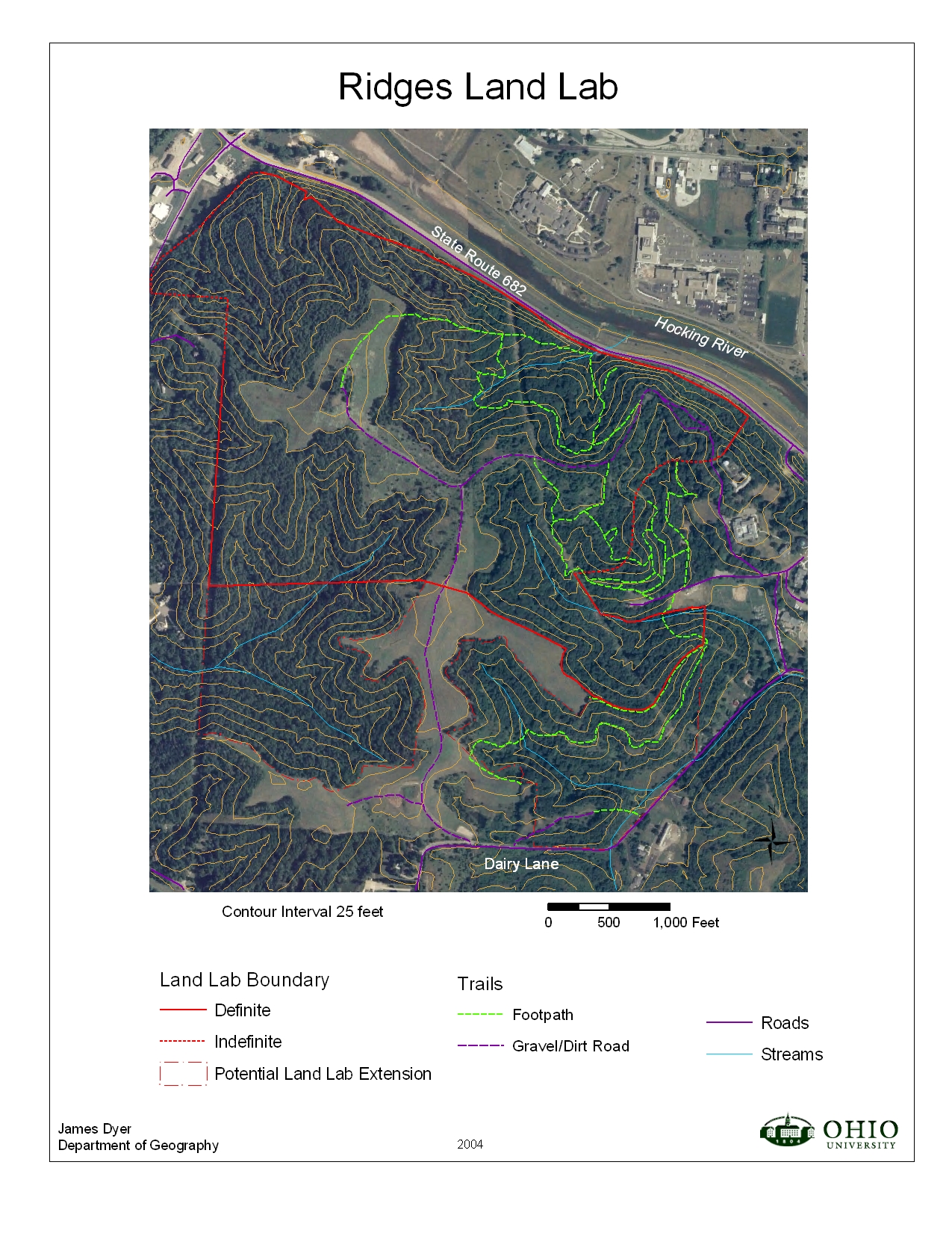
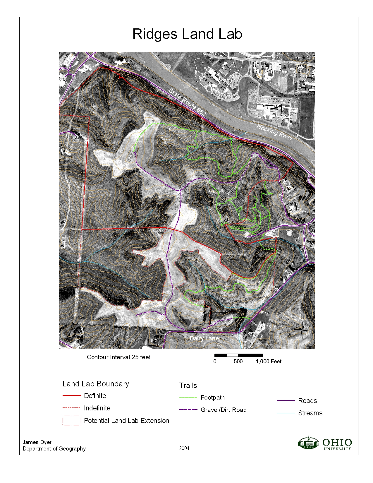
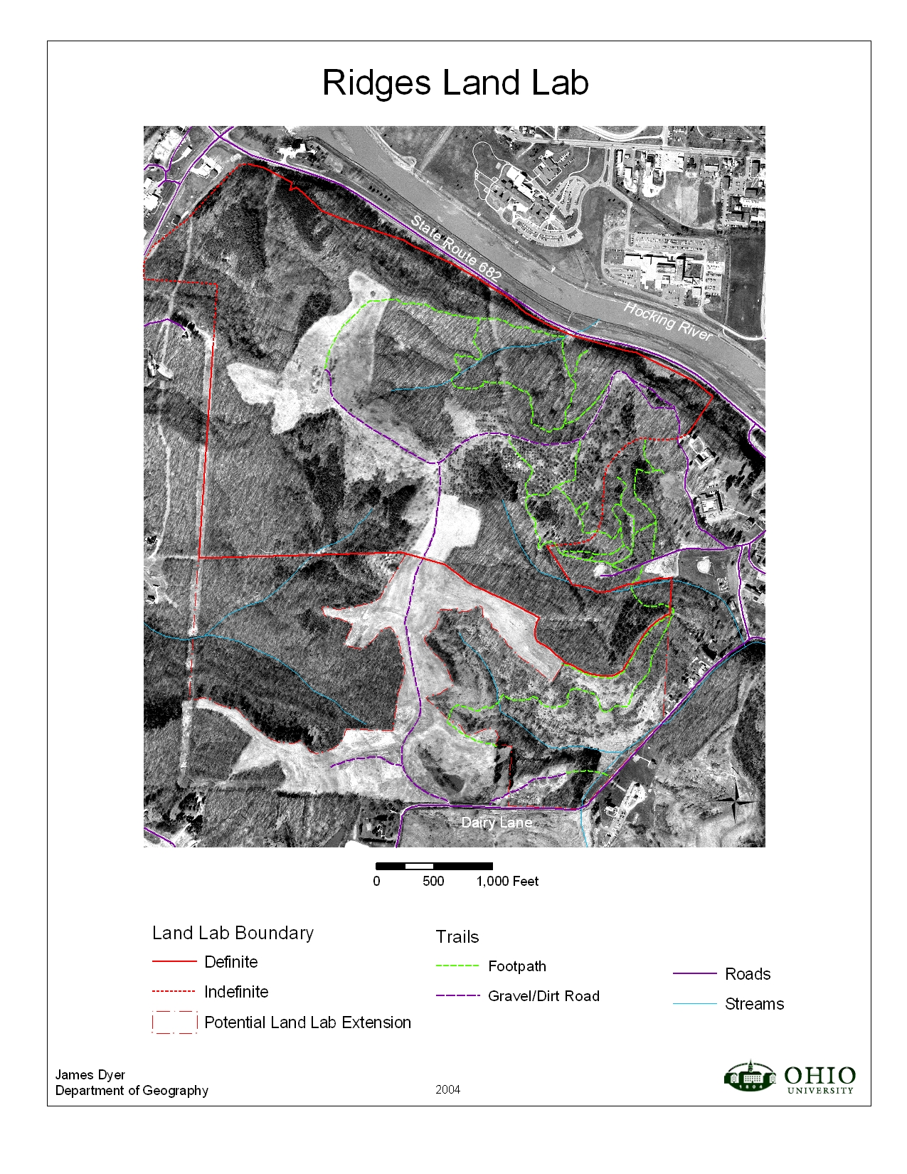
Map 1 : Orthophoto, with land lab boundary, trails, contours, roads, and streams
Color [NAIP 2005] :
jpg format pdf formatBlack & White :
jpg format pdf format
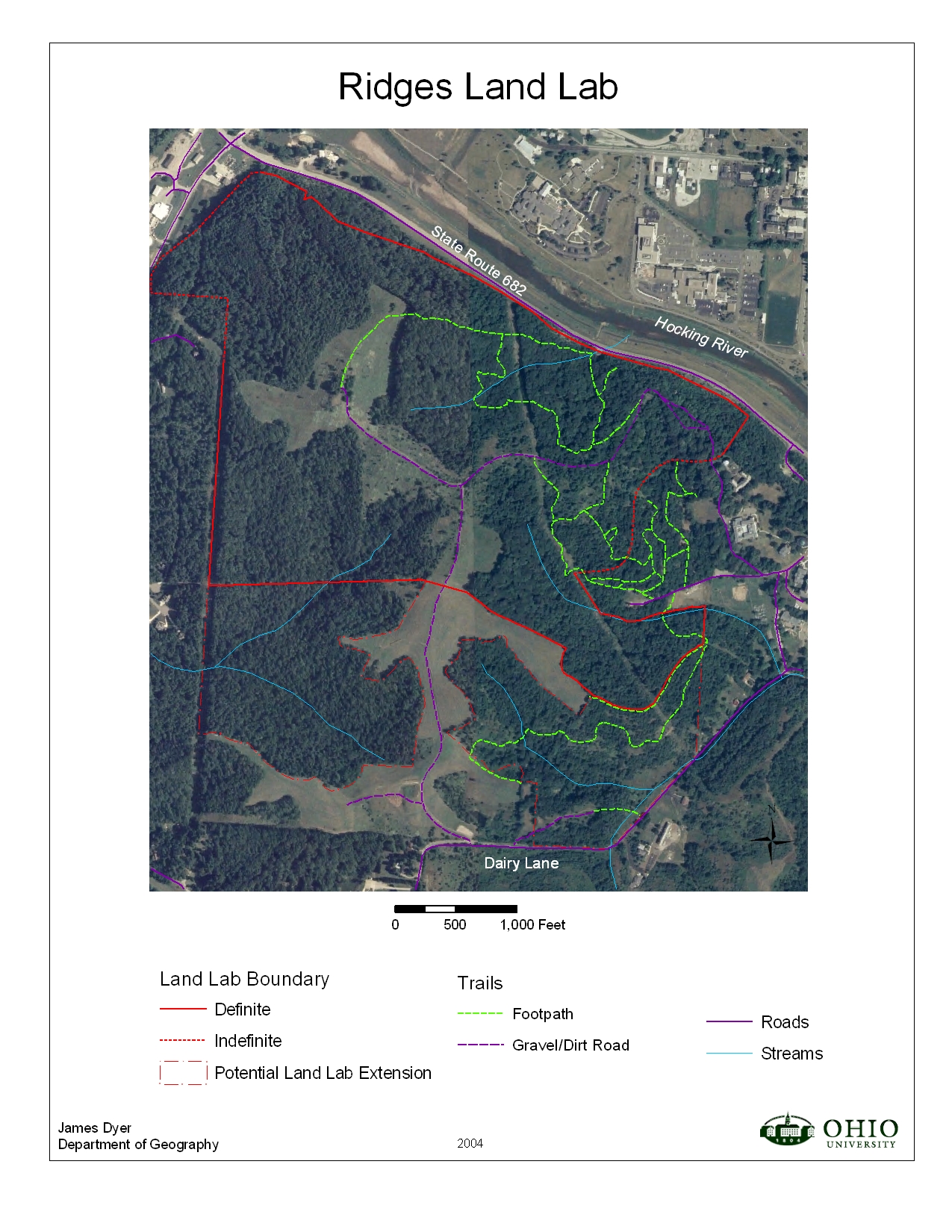
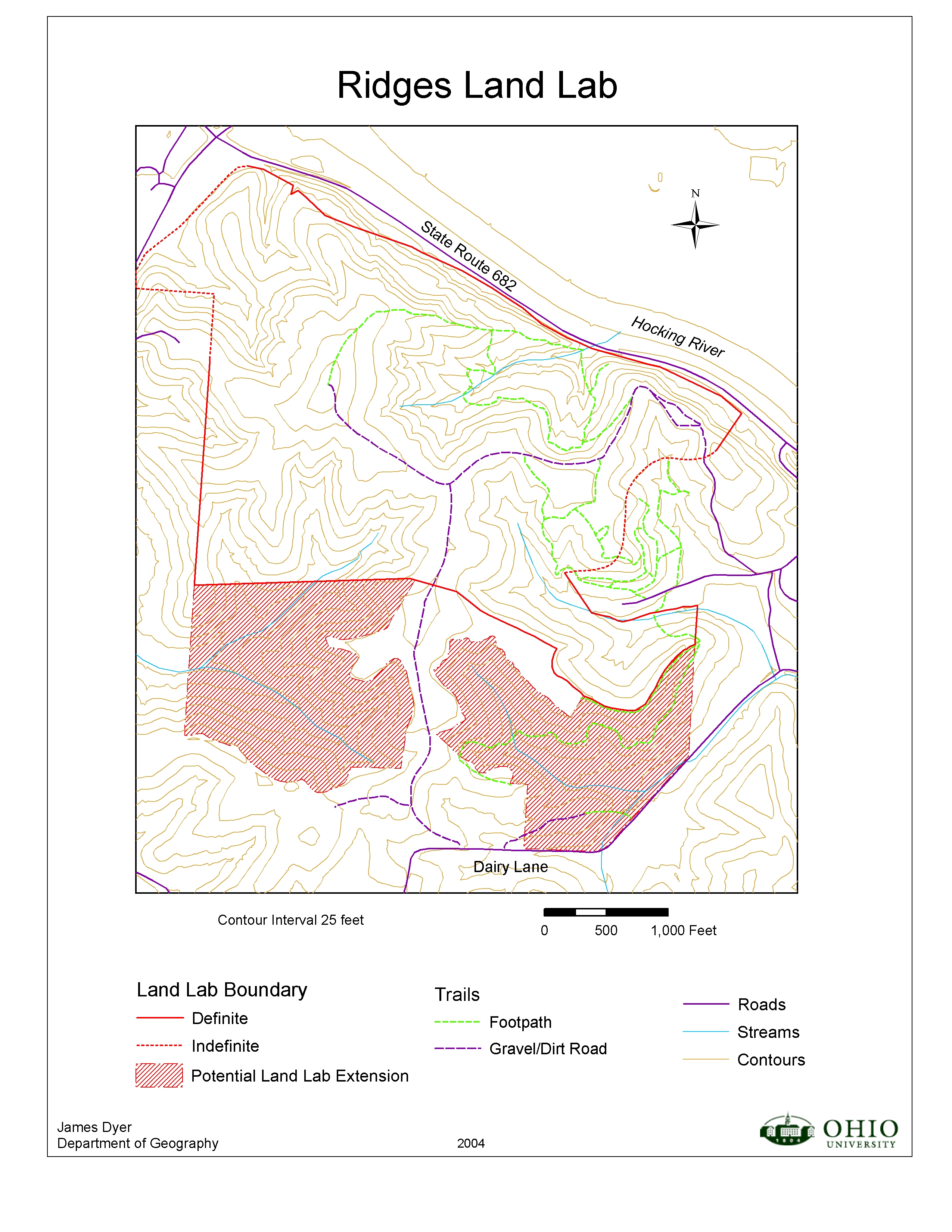
Map 2 : Same as Map 1, but without contour lines
Color [NAIP 2005] :
jpg format pdf formatBlack & White :
jpg format pdf format
Map 3 : Same as Map 1, but without orthophoto base jpg format pdf format
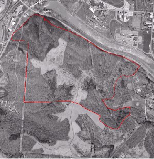
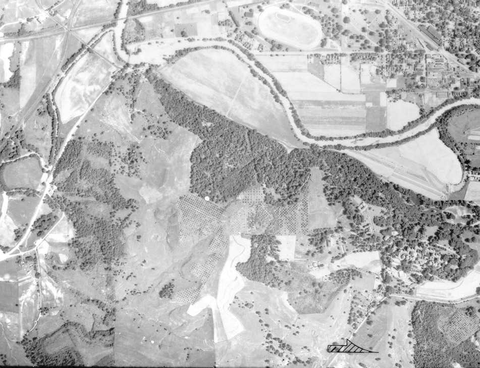
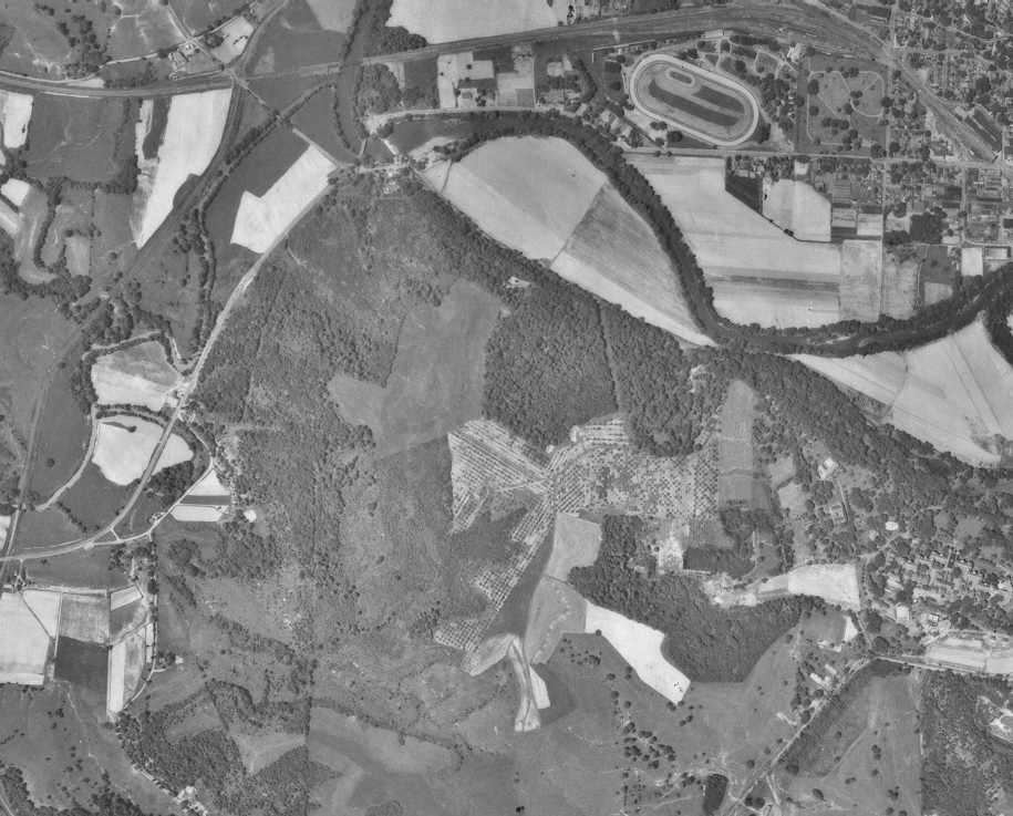
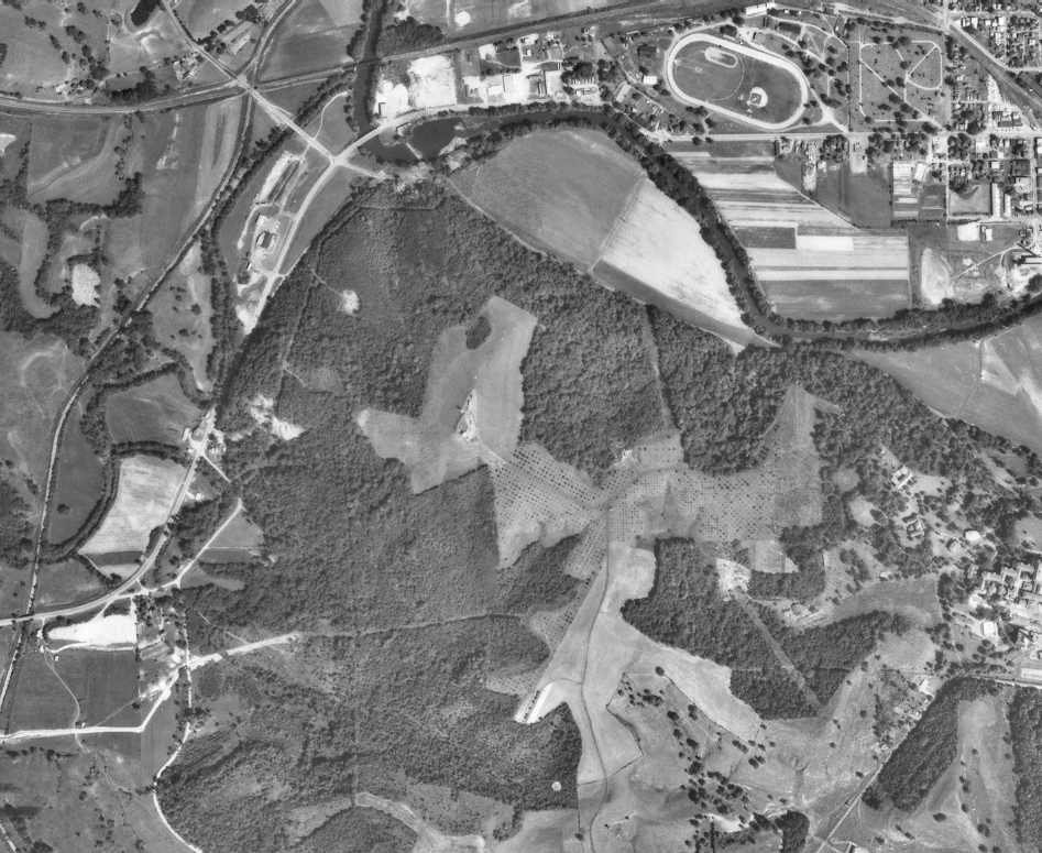
Air Pho tos of Ridges Land Lab & Vicinity (jpg format):
1939 1951 1966
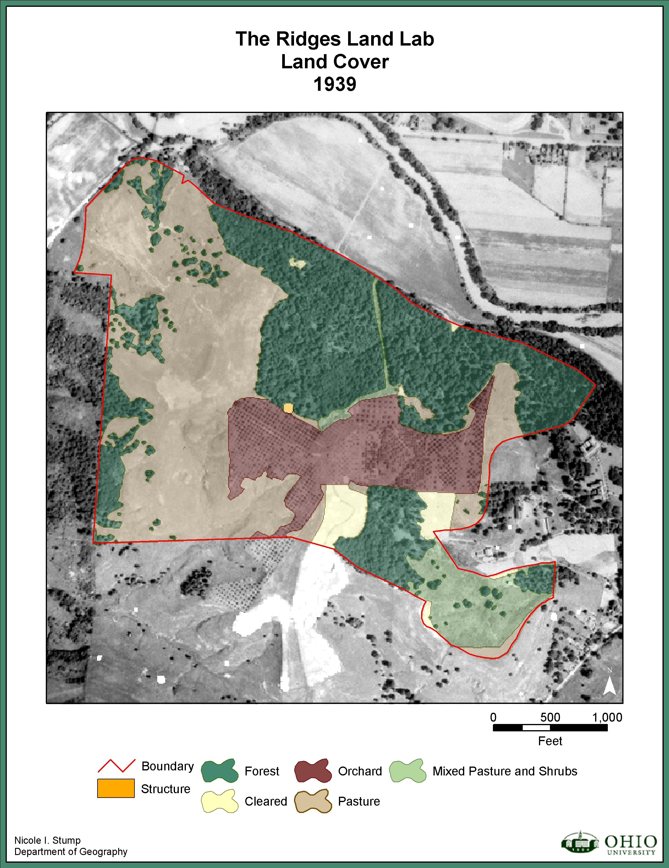
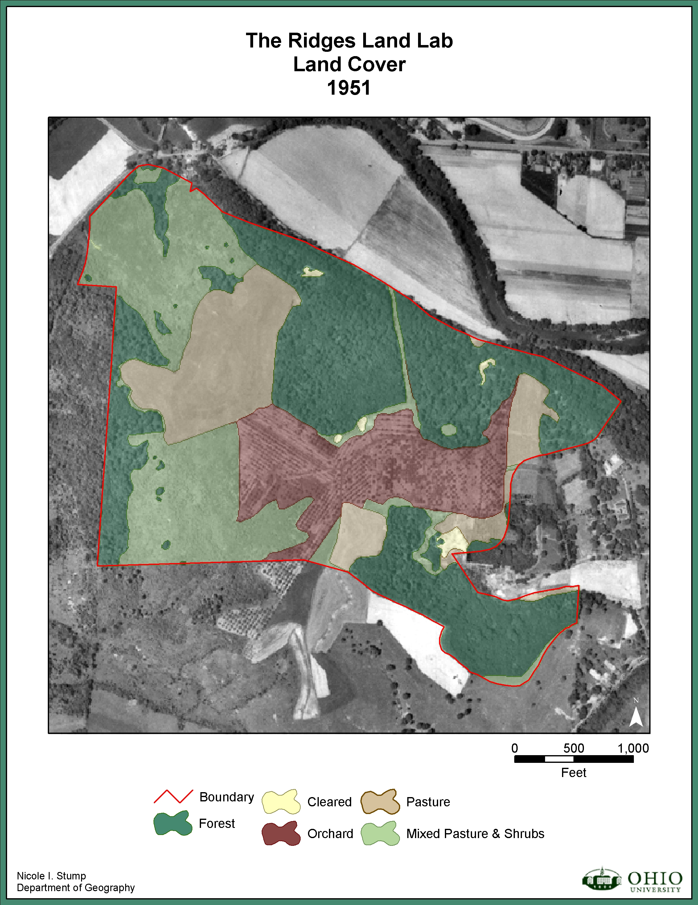
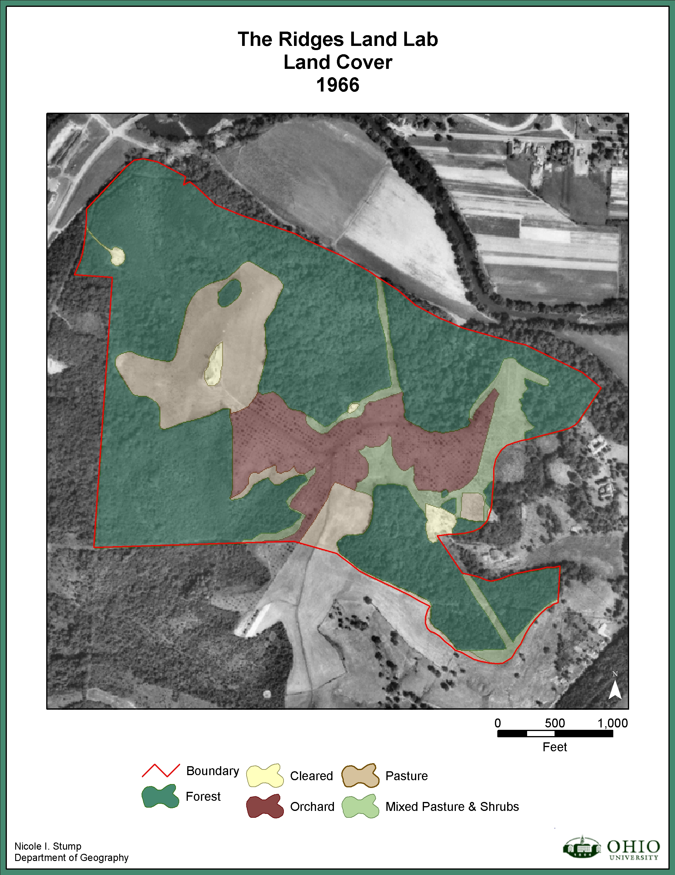
Land Use / Land Cover
(thanks
to Nicole Stump)
1939: jpg format pdf format1951: jpg format pdf format
1966: jpg format pdf format
2002: jpg format pdf format
Questions can be directed to Jim Dyer
, Department of
Geography, Ohio University.
E-mail: dyer@ohio.edu
.